Connectivity Map
What is LightBox Digital Divide Mapping?
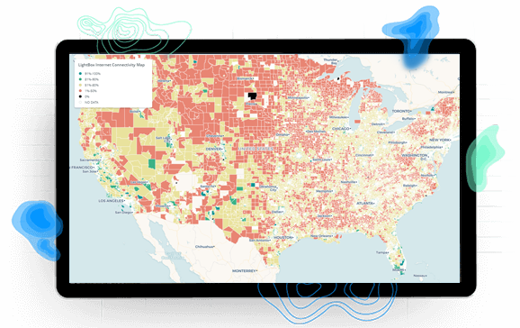
LightBox nationwide SmartFabric provides high accuracy locations, occupancy classification, and business and residential unit count for structures. LightBox Data Solutions provides intelligence on broadband served and unserved structures. Together they are the foundation for the LightBox Digital Divide Map, a better map for understanding the broadband served and unserved.
Our Digital Divide
60 Million Americans Currently Unconnected To Broadband
LightBox Digital Divide Map
Identify Areas With High and Low Broadband Connectivity
What is the LightBox commitment to digital equity?
LightBox recognizes that accurate and granular maps, based upon precise location data, serviceability, and analytics are required for government investment to be targeted and rapidly deployed to communities in need.
In 2019 LightBox leveraged their data expertise in broadband mapping for the first time in Georgia. There, we demonstrated the expediency and utility of accurately identifying broadband coverage for every location throughout the state. With the leadership of the Georgia Technology Authority and various partners, Georgia was able to use LightBox Location Fabric data to gain an accurate, comprehensive picture of every address state wide. The GTA then created a robust policy framework from identifying more than 400,000 additional unserved areas that other broadband map providers were unable to identify.