LIGHTBOX Feature Service

Nationwide Property Data Delivered via Feature Service

LightBox nationwide data is available via Feature Service. LightBox data via Feature Service allows users to use LightBox data directly in an Esri-compatible platform. Easily work with LightBox’s rich address, parcel, building and assessor data.

What is the LightBox Feature Service?

LightBox offers a comprehensive and dynamic data Feature Service that enables users to access, visualize, and analyze spatial data seamlessly. This service provides real-time updates and detailed information on various geographical features, making it an essential tool for decision-making in industries such as real estate, urban planning, and environmental management.

Data Center Site Selection with Feature Service


Why LightBox Feature Service?

Related Insights

blog How Builder Developers Use LightBox Vision for Site Selection
How Builder Developers Use LightBox Vision for Site Selection

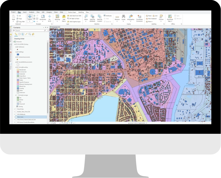
In today’s world of big data, the ability to harness and synthesize comprehensive datasets has become a necessity…

blog GIS Mapping Software Case Study: Toll Brothers
GIS Mapping Software Case Study: Toll Brothers

Problem: Identifying sites and acquiring land across 24 states is a lot of ground to cover. Toll Brothers…

blog LightBox Vision (formerly LandVision) helps DignityMoves Non-Profit Organization find prospective property opportunities
LightBox Vision (formerly LandVision) helps DignityMoves Non-Profit Organization find prospective property opportunities

DignityMoves is a non-profit organization that believes every community deserves interim supportive housing for the homeless that is…

Have questions? Want a demo? Let’s chat.

Fill out the form below and a member of our Sales Team will contact you shortly.