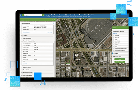
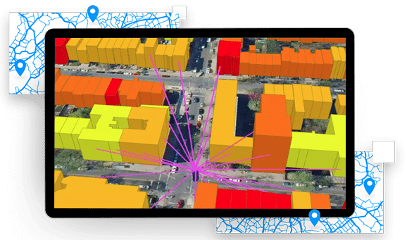
Comprehensive mapping software, analysis and management for industries including real estate and government sectors….
Learn moreSmartFabricSM
The broadest, deepest, most accurate location intelligence in one accessible place
SmartFabric integrates the breadth and depth of LightBox’s geospatial data solutions to create comprehensive and highly accurate mapping giving you the ability to find exact property location details.
Request A Demo Download Data Sample
Why choose SmartFabricSM
Connected data assets
Access to the most reliable location and property data including parcels, building footprints, addresses, tax and deed data, zoning information, residential and business usage, business unit counts, and more
Data management
Built on a consistent data model for straightforward data onboarding and integration
Continuously improved and refreshed
LightBox continuously refreshes delivers high accuracy accurate data for all 50 states, D.C. and U.S. territories, all built from over 5000 sources of data
LightBox Identifier
Our unique, persistent identifier to view connected data assets
Built for how you want to consume the data
Integrate LightBox SmartFabric into your business processes with your preferred data and geospatial technology stack and integration methods including bulk data ingestion or API usage
Match and append
Easily connect third-party, public or your own proprietary content with LightBox data assets
Parcel Boundaries and property characteristics
Nationwide parcel boundaries combined with over 350 property and tax attributes
Determine precise property data
Uncover detailed property characteristics and precise parcel boundary locations for 100% of the US population
Understand property ownership
Find the owner of any property
Identify assessed value and transaction history
Understand assessed land values, improvement values and percentages, and the property tax paid dating back up to 25 years.

Building footprints

Hyper-accurate building data designed to answer critical questions
Zoom in on essential details
Explore nationwide coverage of building shapes greater than 250 square feet for more than 99% of the US population.
Access more attributes
Gain insights to precise rooftop-level location, as well as primary and secondary addresses, building height and perimeter ground elevation.
Link to relevant data
Connect with parcel/assessor/addressing data as well as points of interest.
Addresses
The most comprehensive universe of addresses at the highest level of accuracy
Multi sources dataset for precision location
Built from over 1,900 sources covering 250M+ addresses from simple single-family homes to large office buildings with multiple secondary units.
More than just latitude and longitude
35+ distinct address attributes including geocoordinates and geoprecision codes.
Clean and verified
Our unique address standardization and matching algorithms help fix spelling errors and complete addresses that have missing or invalid components to provide more precise results.

Get insight to Broadband availability nationwide
The LightBox Connectivity Map helps you visualize the broadband served and unserved.
Connected Data
Address Point
Address information for single family home, multi-unit dwellings or large office buildings with multiple secondary units and address information from multiple streets.
Owner and Mailing Address
Property owner and owner related information that are derived from the latest property sales transaction.
Parcel Boundaries
Nationwide parcel boundaries with 300+ property and tax attributes to help you make more confident decisions. Covers 3,100+ U.S. counties including territories, with over 150 million parcels with polygon geometry that is completely normalized.
Building Footprints
Building footprints are geospatial boundaries that provide the outline of a building drawn along the exterior walls.
Property Characteristics
Official record of property characteristics that is from property tax assessment.
Airport Boundaries
The Airports dataset delineates the geographic boundaries of public and private airport facilities. Individual airport boundaries include associated terminals, hangars, maintenance and outbuildings as well as, runways, tarmacs, helipads, parking areas, and satellite parking lots.
School Boundaries
Schools provides three layers of geographic information, including school points, school districts, and school attendance zones, for more than 10,000 public and private school districts in the United States.
Golf Course Boundaries
Golf Courses delineates the physical extent of public and private golf courses across the United States. An individual golf course boundary will typically include greens, fairways, the clubhouse, parking, maintenance and outbuildings. Residential developments that are associated with the golf course may also be included.
Postal Code Boundaries
Postal Code Boundaries provide spatial demarcations of U.S. and Canada Postal codes. This dataset also includes the centroid location for each ZIP code and over 60 million deliverable USPS ZIP +4 addresses.
Neighborhood Boundaries
Neighborhood Boundaries give context to local geographies. This data set includes airport and golf course boundaries as well as demographic, crime and income statistics and point of interest locations.
College Boundaries
Colleges provides a series of polygonal boundaries around two-year and four-year colleges and universities in the United States with an enrollment greater than 200. The boundaries reflect both main and satellite campuses.
Hospital Boundaries
Hospitals delineates the boundaries of general care hospitals with 24-hour emergency services and specialty hospital types (VA and cancer centers) located in the United States.
Have questions? Want a demo? Let’s chat.
Fill out the form below and a member of our Sales Team will contact you shortly.