
In today’s world of big data, the ability to harness and synthesize comprehensive datasets has become a necessity for commercial and residential developers alike. We talk to developers every week who share how the stalled commercial real estate transaction market increases the importance of achieving pinpoint precision to deliver high yields on investments.
Whether developers are scouting land for ground-up development or aiming to enhance existing sites, the goal remains the same: to identify sites that offer the highest ROI. More than 20,000 builder developers use LightBox LandVision tool. The top three data points developers are currently using to aid in their site selection are zoning regulations, environmental concerns, and sophisticated demographic analysis. Below, we share context around these hot topics in developers site selection process.
Zoning Regulations
Considering the rising trend of adaptive reuse in the real estate sector, developers are increasingly focused on understanding zoning regulations. Tools like LightBox Vision provide valuable insights into the zoning of each parcel, allowing users to explore opportunities for repurposing existing sites. Our research indicates that approximately 20% of properties in the United States have zoning designations that permit multiple uses, offering developers the potential to maximize their return on investment through strategic transformations. However, it is important to not only understand the zoning of each site but of the surrounding area around the site as well, so the project avoids being at odds with the neighboring area.
Before adopting LightBox Vision, DignityMoves, a non-profit organization on a mission to provide interim supportive housing for the homeless in California, faced significant challenges in identifying suitable properties for their modular housing units. They struggled with the time-consuming process of physically scouting potential sites, navigating the California Environmental Quality Act, and pairing that with zoning regulations to identify usable land. With the implementation of LightBox Vision, DignityMoves can leverage the comprehensive zoning data and mapping features to help them efficiently pinpoint properties that align with their mission, saving time and resources while increasing their success rate in acquiring usable land for their initiatives.
Environmental Concerns
The rise of adaptive reuse of industrial sites, aging infrastructure and climate change have all contributed to the weight EPA reports have on site selection. Areas with a history of heavy industrial activity, such as manufacturing facilities, chemical plants, or mining operations, are more likely to have higher concentrations of EPA hazard reports. Additionally, regions with older infrastructure or legacy pollution may also exhibit elevated levels of environmental contamination.
While the majority of our LightBox Vision users interact with our tool prior to selecting a site, it’s worth sharing the experience of a client who adopted the tool after selecting a development site. Their chosen site straddled a census tract boundary, transitioning from a high-income to a low-income area. When the client performed an address search, LightBox Vision revealed there were EPA cleanup issues across the street, resulting in unexpected delays and complexities to the development project. Had LightBox Vision been utilized earlier, this critical information could have influenced their decision to move on the site or, at the very least, provided foresight to address the cleanup challenges proactively.
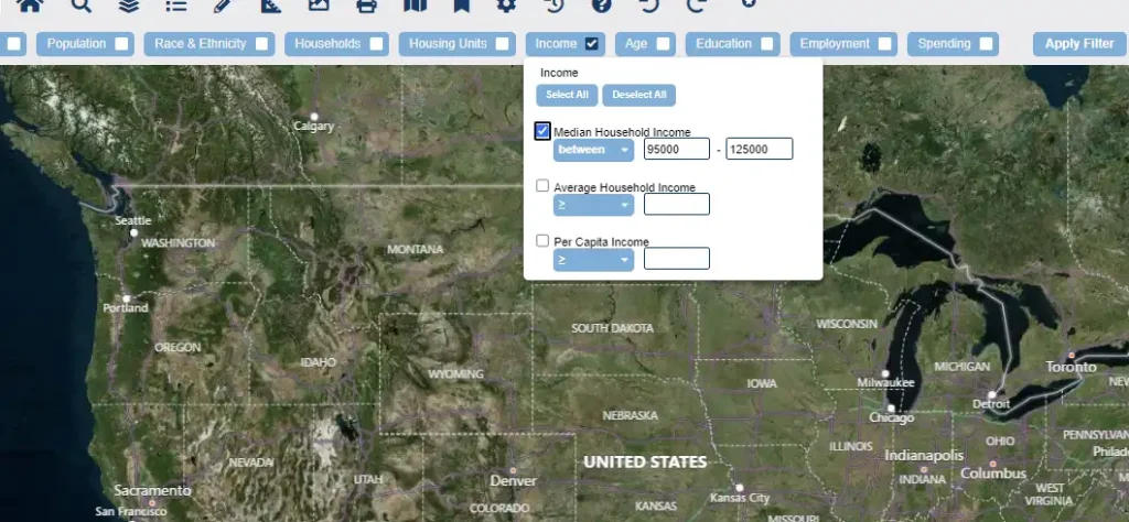
Comprehensive Demographics Analysis
Both commercial and residential developers rely heavily on comprehensive demographic insights, but what is equally important is the ability to layer the datasets. There are numerous ways to splice demographic data, from population growth, income levels, school districts, retail saturation, drive-times and more. LightBox Vision gives developers the ability to toggle layers of data on and off depending on which datasets are important to their project needs. For instance, if the developer is looking to add value-oriented retail like a dollar store, they will be studying not only the income level in a given area, but also the saturation of similar stores in the region, education levels and age of population to give them insight into analysis of ROI. Users love the versatility in handling demographic data layers that seamlessly integrate with building data to speed up their decision-making process.
Looking Ahead
The integration of data-driven solutions like LightBox Vision transforms the site selection process for developers, giving them the pinpoint accuracy they need to identify high-yield sites in today’s slowed transactional market. By leveraging comprehensive datasets that can be layered on top of each other and allow flexibility in terms of which layers are turned on, developers’ site selection process is enhanced, giving them the speed to market to acquire sites that have maximum potential for return.
Stay tuned for an upcoming piece, where we will explore how LightBox Vision can help developers identify off-market opportunities through market-wide analysis allowing effective direction and employment of resources to capitalize on emerging opportunities.