
Professionals doing geospatial work require precise location data to solve a variety of business problems—from the most basic to the very complex. LightBox helps public and private organizations manage a large variety of location-based tasks, from state and local agencies that require assistance with broadband mapping to firms of all sizes using location data for land acquisition and property inspection needs.
- GIS professionals rely on geospatial data for a wide range of tasks
- Accurate locational information is crucial to generate meaningful insights
- SmartFabric offers a complete universe of addresses that can be connected to other data points, generating a comprehensive view of any property
A flexible, modeled fabric to help customers meet any challenge
SmartFabric was developed to integrate our core parcel, building footprint, address file, geocoding, and tax assessor details in a proprietary and flexible modeled fabric—after customers told us they needed solutions for day-to-day challenges such as:
- Getting the most accurate location possible
- Avoiding incorrect locations assigned to addresses
- Locating any address, whether business or residential, rural or urban, old or new
- Receiving additional context about the parcel, building, occupancy, and land associated with the address
Flexibility in consuming and analyzing data is the key to success. For example, for broadband mapping, you can create your own definitions of broadband serviceable locations and overlay layers such as demographic information, a multitude of boundaries, speed data, Internet service providers (ISP) service areas, and customer data sets. With SmartFabric, you can perform three core tasks:
- Access the most expansive universe of legitimate addresses in the U.S.
- Locate those addresses with the highest amount of precision possible
- Connect every address to the widest variety of information from other datasets
You save money and time working with a company that sources, creates, and owns the parcel, assessor, building footprint, and address data that are combined in SmartFabric and can respond to customers’ needs quickly and efficiently.
What would you do with a comprehensive, up-to-date universe of addresses?
Our address universe contains more than 250 million unique base addresses (such as 10 Main Street) and secondary addresses with greater detail (10 Main Street, Apt. B-37) across the U.S. This universe includes residential, commercial, government, and other properties. To give our customers access to data about every address, we combine and cross-reference data from many sources:
- Our situs address universe, where land parcels have addresses
- Our locally collected address sources, which includes more than 2,000 unique sources of address information from cities, counties, regional areas and states—every quarter, newly available data is added
- U.S. Postal Service data that provides a signal on mailing addresses
- Consumer lists that provide a signal on addresses that are in use
- Other open sources of address information that provide insight into particular dimensions of addresses, such as apartment complexes, low-income housing sites, and more
- Additional commercial sources of data that augment our own data and fill in critical gaps
These sources are refreshed each quarter, adding millions of additional addresses. Combining these sources helps users avoid any biases that might result from depending on a single source. For example, a situs address universe is biased toward addresses associated with land, land transactions, and property taxes, limiting its potential use in certain situations.
It’s not enough to have a large universe of addresses. All data sources are cleaned, validated, and cross-referenced to ensure the volume of low-quality data remains minimal. Addresses are tested every quarter against reference businesses and consumer databases so that you are provided with only the highest quality data.
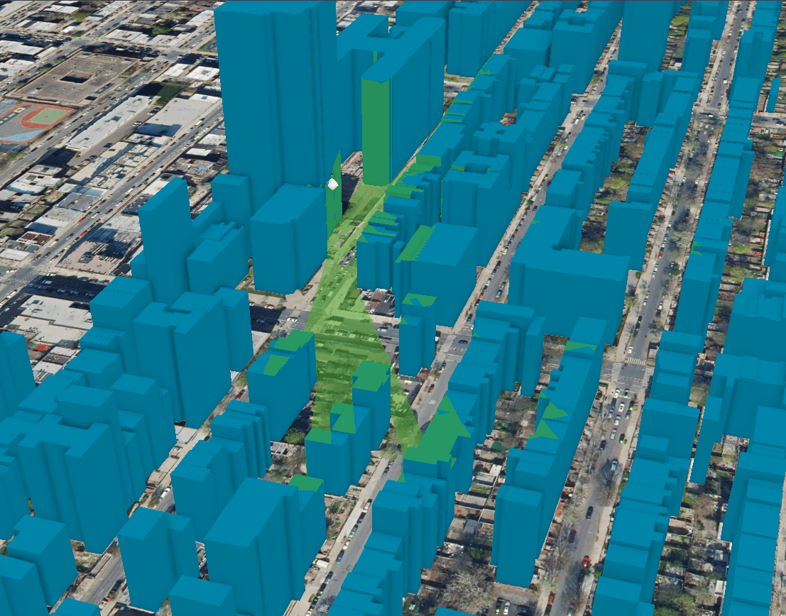
Locate every address with the highest degree of accuracy possible
We have developed sophisticated processes to merge address information with building footprints, and more than 80 percent of SmartFabric addresses are rooftop accurate. Our methodology is rigorous about accuracy: The rooftop must be clearly on the building, not just on a parcel centroid.
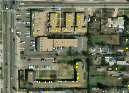
What benefits does this provide our customers? You have the highest accuracy location possible to perform your spatial analysis, determine a destination location, or understand a location of an address within a building.
Generate fresh insights by connecting address data to other rich sources of data
Customers can easily answer basic questions, including:
- What kind of building is located at a given address?
- For any given address, what other addresses are in the building?
- What attributes—such as occupancy, value, ownership, and more—are associated with that address?
- Is an address associated with more than one parcel of land or assessor records?
Geocoding or locating an address is frequently the first step in analysis. SmartFabric provides the linkage or relationships between all of our data elements.
With SmartFabric, you can start with an address and connect to virtually any other address or georeferenced data element. Clients who have their own data or additional data they license from another party can connect it to the SmartFabric model.
Empower decision-making with quality, precise, up-to-the-moment data, tailored to your needs
Streamline your workflow with:
- The largest universe of high-quality address information: Spend less time determining where your ungeocoded addresses are located
- The highest precision locations: Trust that your analysis or downstream use of the geocoded points will be solid
- The highest quality data: You no longer have to worry about bad geocoding and inaccurate locations
- Data updates every quarter that are meaningful: Every quarter SmartFabric provides you with detail on new development and difficult-to-map areas
- A product that you can readily integrate with any technology you choose: Open source? Commercial products? Your choice of database? Yes, yes, and yes